Third
grade has been hard at work learning about the fascinating geography of
China. A country of many different landscapes, China's unique
geographical features have long impacted the history and people of China.
In our early geography lessons, we studied the different landforms of
China. Students had to match pictures of
different landforms and figure out the definitions based on the visual
cues.

 In
class, we had a presentation on the geography of China and learned about the
natural and man-made borders of China, including the fourteen countries that
surround China. Students noted the number of times the
country of India borders China, and remarked upon the location of the rivers that
we've read about in some of our Chinese folktales. We also learned many
important facts about the about many of the major deserts, mountain ranges, and
waterways in China.
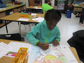
For each landform, students created a symbol to
represent it and carefully located it on the map. These maps will become
the base of our geography studies this semester, and we will add different
elements to our maps each month to explore where major landmarks are located,
how the land is used, what lives there, and other interesting ideas.


No comments:
Post a Comment